.jpg)
In Aurlandsfjord
The a long inlets of sea carved into the mountains of south-western Norway are quite simply breathtaking. It is no wonder that parts of this Norwegian fjord landscape are UNESCO-listed.
You could say that the Norwegians invented fjords.
Their country is certainly home to some magnificent UNESCO-listed examples, and it is they who originated the word.
A rough line around Norway’s sea borders (the coastal perimeter) adds up to about 2,500 kilometres (1,600 mi). But, if you measure what is called the ‘low-resolution coastline’ which includes the nearly 1,200 fjords, islands, and bays, this perimeter increases tenfold to over 25,000 kilometres (16,000 mi).
The word “fjord” comes from an Old Norse word fjǫrðr (verb: ferd “travelling or ferrying”) for a lake-like body of water used for passage and ferrying. It has been adopted internationally – complete with the Nordic spelling (except in some place names, and in New Zealand English, where ‘fiord’ is preferred) – to describe the long, deep inlets of sea between high cliffs that were formed by the submergence of glaciated valleys. By geographic definition, a true fjord is created when years of glacial weight and abrasion cuts a U-shaped valley into the surrounding bedrock, and this is then flooded by the ocean.
Ironically, in Norwegian, Danish, and Swedish, the word fjord has a more broad and general usage than it does in English and in international scientific terminology. In modern Norwegian, fjord can refer to any inlet, channel, or long narrow body of water – even long, narrow freshwater lakes. This disparity of meaning has often lead to some confusion.
But, there was no doubt or confusion about the two fjords I was on: Aurlandsfjord, and the adjoining Nærøyfjord. Both are branches off the 205-kilometre long Sognefjord in Vestland county, Western Norway. Sognefjord, nicknamed the King of the Fjords, is the largest and deepest fjord in the country; Nærøyfjord, the narrowest and best known arm of the extensive Sognefjord system, has been called part of an “archetypical fjord landscape.”.
I had a full day in Flåm (see: A Walk in a Norwegian Wood), which sits at the inner end of Aurlandsfjord, and I took the opportunity to board a scenic cruise into the fjords. The shoulder season didn’t start until the next day (May 1st), so there were limited offerings. I was lucky, however, and managed the get onto the last afternoon sailing of the new hybrid catamaran, the Vision of the Fjords.
The two hour trip started from Flåm, and paused to take in some of the more spectacular of the many waterfalls in Aurlandsfjord before switching to full-electric mode and sliding quietly along the Unesco-listed Nærøyfjord to the tiny settlement of Gudvangen. From there, after the requisite souvenir shopping, we all boarded buses, and rolled back towards Flåm in the dark. The sun had already ducked behind the steep mountains: except in full summer, daylight can disappear pretty quickly in these deep valleys.
This is one of those landscapes you really have to experience for yourself; pictures cannot do justice to the sight of the valley walls rising straight up all around you, the deafening noise of the crashing waterfalls dropping hundreds of feet into the waters below, and the feel of the crisp spring air on your face as your tour boat slices through the narrow fjords.
Even so, I hope these pictures give you a small taste:
.jpg)
Passengers on the Upper Decks
The external gangway on the multi-story Vision of the Fjords ship was designed to suggest a twisting mountain road. It allows passengers uninterrupted views of the passing scenery.
.jpg)
Flåm Harbour
The upper deck of the award-winning sightseeing catamaran provides a great vantage point over the marina and the harbour.

Leaving Flåm Behind
The Vision of the Fjords can travel up to 19 knots; as we motor through Aurlandsvangen, we can no longer see Flåm behind us.

Boats on Aurlandsvangen
There is quite a mix of traffic on the fjord.

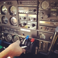
Marine Equipment
Aurlandsfjord is 29 kilometres (18 mi) long and can reach depths of 962 metres (3,156 ft) below sea level. We have every kind of navigational device that our captain could possibly want to help him navigate a channel that is generally less than 2 kilometres (1.2 mi) wide.

Aurlandsvangen on Aurlandsfjord
The village of Aurlandsvangen is tiny (pop <1000), but not as isolated as it looks: it is serviced by the fjord, and a national highway.

Aurlandsvangen on Aurlandsfjord
Dwarfed by the surrounding mountains, the buildings look bright and cheerful in the afternoon sun.

Mountains on the Fjord
The mountains rise up to 1,800 metres (5,900 ft) all around us; …

Spring Snow
… fresh snow dusts the tops while old snow clings to shady crevices.

Flying the Flag

Village on the Fjords
The fjords are only sparsely populated, with tiny hamlets clinging to small valleys in the lee of the mountains.

Undredal
With a population of just over 100 people, Undredal is known for its goat cheese, and a wooden stave church dating to 1147.

Gull on the Wing

Aurlandsfjord

Lægdafossen on Nærøyfjord
We turn into Nærøyfjord and pause to admire one of the many magnificent waterfalls …

Bottom of the Falls
… cascading down the rocky mountainside.

Nærøyfjord

Fjord Safari
Thrill-seekers get closer to the waterfalls than we do in our big ship.

Enjoying the Sights
But, even on our vessel, it is cool and windy.

Dyrdal Badaplass on the Fjords
All these tiny hamlets have substantial wharves: water is the only means of access for many of these settlements.

And the Mountains go Forever!

Another Waterfall

Hamlet on the Fjords
The masifs around us are awesome in the sunlight, but can you imagine how oppressive they might feel in the cold, dark of winter?

In Nærøyfjord
With only the electric motor running, we glide almost noiselessly through the icy waters.

Bakka Kyrkje
Built in 1859, Bakka Church seats about 200 people. I wonder how far the faithful travel, as there can’t be that many people in the village!

Gudvangen Dock
This is the end of the 18-kilometre (11 mi) long Nærøyfjord.

Georg Hansen and the Prow of a Knörr
As we disembark in Gudvangen, we are greeted by Viking iconography. Dragons and snakes were popular figureheads for Viking longships because they were thought to strike fear into the spirits of the foreign lands being raided.

Falling light over Gudvangen
There is still light on the mountaintops around us as the time comes to leave, but very little makes it into the deep valley.

It is a truly magnificent landscape, and notwithstanding some controversy surrounding the touristic Viking Village at Gudvangen, it is clearly being well managed for the future, with respect for the environment, and a regard for past traditions and history.
Until next time!
Photos: 30April2018


.jpg)

