Dandelion Cliffs
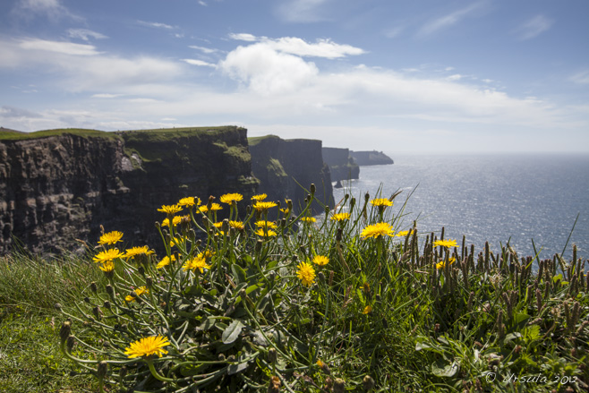
Sunny dandelions greeted us as we climbed the walkway to view the magnificent Cliffs of Moher, County Clare, Ireland.
It was pouring.
Of course it was! It rained every day of our visit to Ireland last June. Not all day, but every day.
The silver lining was that were were going to be comfortably seated on a bus tour of County Clare all day, and not walking the wilds of the Dingle Peninsula, County Kerry, as we had been the day before. And, it IS that rain, after all, that makes Ireland the “Emerald Isle”.
We were meant to be heading into some of Ireland’s “most stunning scenery”. So, we picked up our umbrellas, packed our raincoats, and crossed our fingers.
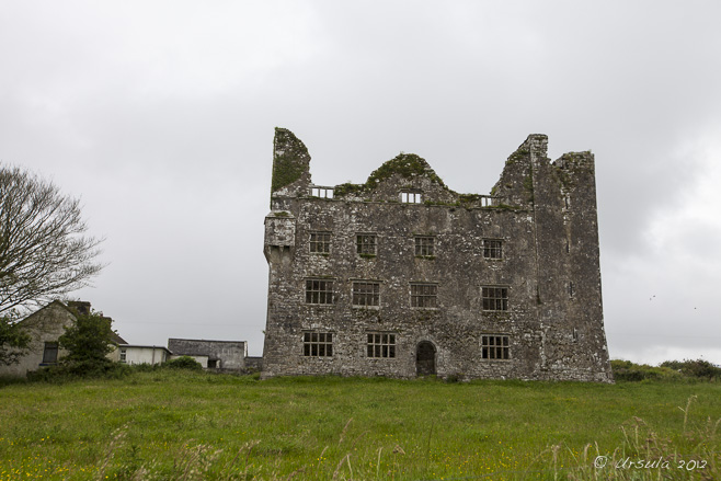
It was still pouring when we arrived at our first brief stop at the ruins of Leamaneh Castle; my husband (holding the umbrella) and I (wielding the camera) were the only members of the tour group who even got out of the bus.

Leamenagh Castle Ruins
The original Leamenagh Castle was built around 1480 by one of the last High Kings of Ireland. The manor house was added in 1648 by Conor O’Brien and his wife, Máire ní Mahon. Connor died early, and his widow became known as “Máire Rúa” (Red Mary) due to her flaming red hair. She is one of the most infamous women in Irish folklore, probably because she was able to retain her estate via two politically astute marriages.
The rain continued as we pulled up to our second, longer, stop at Caherconnell Stone Fort, a stone ringfort dating back to 400 AD. We braved the wet and took the self-guided tour through the magnificent stone ruins.

Caherconnell Stone Fort
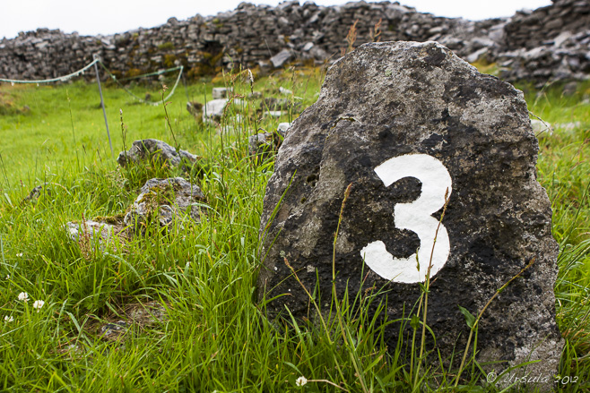
The self-guided tour takes the visitor through the ringfort, built by farmers around 400 AD and left much as it has been found.

Walls of the Fort
Like other ringforts, Caherconnell was probably built as a defence against animals and raiders. Almost perfectly round, and between 140-145 feet in external diameter, it would have housed a small settlement.

Hawthorn
Ringforts are commonly referred to as fairy forts: fairies live in the forts or in the hawthorn trees that grow in them. It is considered unlucky to cut these trees down.

Ferns
The walls are 12 feet thick, built from large blocks, as much as three feet long and two and a half feet high. This makes them a perfect home for moss and ferns.
The rains eased off but the grey skies hovered for our third stop at a portal tomb: the fascinating Poulnabrone Dolmen – a neolithic burial site probably dating between 4200 BCE and 2900 BCE.

Poulnabrone Tomb
Poulnabrone dolmen (Poll na mBrón in Irish, meaning “hole of the quern stones”) is a neolithic portal tomb thought to date to 3800 BCE.

Poulnabrone Tomb
The twelve-foot slab-like capstone sits on slender portal stones. The chamber underneath was the last resting place for almost thirty adults and children, as well as various personal items.

Limestone Pavement
The porous limestone pavement around the tomb is pockmarked and slippery with moss and moisture.
I was thrilled to stop for lunch overlooking Galway Bay, not only because I was hungry and and the food was terrific, but because I could muse about my ancestors who had emigrated from across those same waters only a few generations before.

Galway Bay
Calm waters and a patch of blue sky greet us at our lunch stop in Ballyvaughan Village.

Monks Pub
Justifiably famous for its seafood, the pub was a welcome stop.
As the skies cleared further and the sun came out, we continued southwest across the Burren (Boíreann, Irish for “rocky place”) and stopped for a scramble across the glaciated limestone karst “pavement”.

The Burren
Ponies graze on the short grasses that grow in the sparse soils atop the limestone rocks.

Stone Wall

Still Life Found: Stones and Flowers
Livestock love the Burren because the limestone holds the heat.

Flowers in the Fissures
The vertical fissures (grikes) hold water, supporting pockets of plant life.

Puddles of Life

Bus on the Burren
Our bus sits on the Black Head Coastal Drive, awaiting our return, so we can drive to our last stop.

Cliffs of Moher
Our final stop is at the stunning 214m (702 feet) tall Cliffs of Moher – thank heavens the sun is shining!

Curving Cliffs
The cliffs, which have been used in numerous movies, including The Princess Bride (1987), stretch for 8 kilometres (5 miles) along the Atlantic coast.

Information Centre
The Visitor’s Centre, featuring informative displays and stunning photographs, includes cafeterias, restrooms, and a gift shop. It is built into the hillside, but surprisingly light and airy inside.

O’Brien’s Tower
In the other direction lies O’Brien’s Tower, built in 1835 by Cornelius O’ Brien, and used as an observation tower.

Cliff Tunnel
Comprised of bands of Namurian sandstone, siltstone, and shale, the cliffs are wonderfully varied, and noisy with nesting bird life.

Dandelion Cliffs
One last look at the towering cliffs, and it is time to return to our lodgings in Shannon.

The Great Hunger
On the way home, we stop briefly at the statue of an orphan child at a Poorhouse door – a grim reminder of another facet of Ireland’s long and rich history.
 It was a typical Irish day: starting in rain and ending in brilliant weather.
We heard historical tales – ancient and modern – told with a mixture of poignance and humour. We experienced remarkable sights, natural and man-made.
And, it goes without saying, we ate and drank well.
Sláinte!
Pictures: 28June2012


.png)

