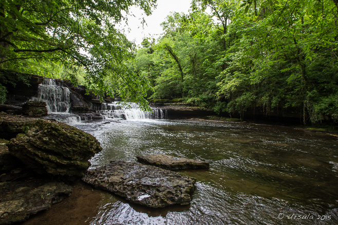
Falls on the Little Duck River
The prehistoric Native-American ceremonial mound site in Manchester Tennessee, erroneously called “Old Stone Fort” by early European settlers, is almost completely surrounded by beautiful waterways – which probably contributed to its selection as a sacred site. (18May2015)
Tennessee is in the middle of “The South”; Middle Tennessee is – as you’d expect – in the middle of the state; and the area south of Nashville is – more or less – “the middle” of the middle.

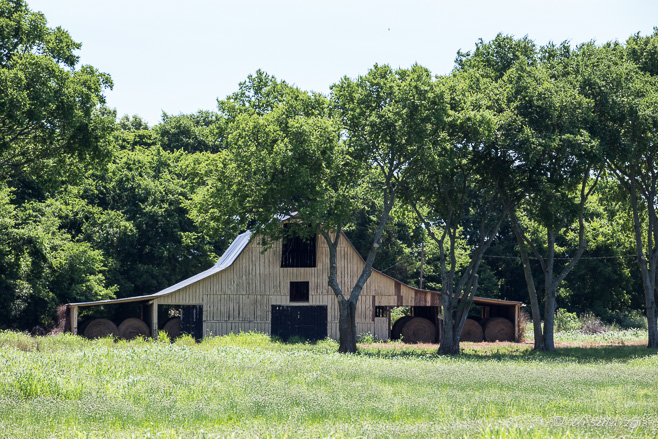
Middle Tennessee Barn
Whether the barns are weathered and worn …
Rutherford County (14June2013)

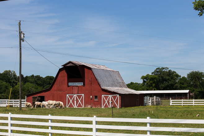
Northfork Barn
… or trim and freshly painted, they are beautifully shaped.
Bedford County (14June2013)
Middle Tennessee is known for its farms, beautiful horses, rolling green landscape, and bluegrass-country music. Although it is defined by the serpentine curves of the Tennessee River, it is its tributary, the Duck River that we see daily when we visit. We have family that was transplanted – many years ago- to Bedford County, just south of Nashville, so we usually include a paddle on a portion of the 457 km long Duck in our stay.

Paddling on the Duck River
Never let it be said that Southerners don’t have a sense of humour: when we go canoeing, our grandson wears a tee shirt with “Paddle faster! I hear banjos.” written on the back. The movie Deliverance was actually filmed in northeastern Georgia, but the countryside is similar.
iPhone6+Snapseed (16May2015)

Eastern Gray Squirrel – Sciurus Carolinensis
The expansive housing estates, with their large properties surrounded by trees, make for plenty of back-yard wildlife. (19May2015)

“Redbird”
The Northern Cardinal (Cardinalis cardinalis) is a non-migratory year-round Tennessee resident. (21May2015)

House Finch and Golden Finch
With the the right kind of seed, red house finches (Haemorhous mexicanus) and American goldfinches (Spinus tristis) are easily attracted to backyard feeders. (21May2015)
I try to do something new and different on each visit, which is not hard because it is an area rich in natural beauty (see: Woods and Waterfalls). It is known for it’s southern country ways: huge cream magnolias and magnificent white colonial homes, fine horses and low-slung barns, “dry counties” and Tennessee bourbon (q.v.: A Shot of Jack).
Presidents have lived there (see: A Mixed Legacy) and there are countless Civil War battlefields and graveyards in the immediate vicinity. The scars haven’t all healed, and the stories are still fresh in people’s collective consciousness.
One of the sites we visited on our most recent trip was the Carter House just outside of Franklin, Williamson County. A guided tour of this State Historic Site is more a story-telling history-lesson than house tour. Most of the house itself – built by Fountain Branch Carter in 1830 for his wife Polly and their twelve children (nine of whom reached adulthood) – is not actually open to visitors. Instead, the guide relates the story of the house and the family, before bringing Civil War history vividly to life as he narrates his account of the Battle of Franklin, one of the most costly defeats for the Confederate States Army.
Before daybreak, November 30, 1864, Union Brigadier General Jacob D. Cox co-opted the house and turned the parlour into his command centre. The Carter family, with their slaves and various neighbours, took refuge in the basement while the battle raged all around. The Carters’ middle son Tod, who had been serving as an aide to Confederate Brig. Gen. Thomas Benton Smith, was wounded in the battle. He was, however, rescued from the battlefields, and died, two days later, in his childhood home.

The Carter House
Deceptively small from the front, the double-story house with basement and various outbuildings, is actually quite large. Over a thousand bullet holes from the Battle of Franklin are still visible in the outer walls. (15May2015)

Carter House Kitchen

Civil War Gun – Carter House – Franklin, Tennessee
The Sam Davis Home, built in 1810 in nearby Smyrna, Rutherford County, was the upper middle class home of the Davis family. Sam, the eldest child, was attending the Western Military Academy in Nashville when the Civil War started in 1861. By 1863, he was a “Coleman Scout”, a scout and courier for the Confederate Army.
On November 20, 1863, he was captured by the Federal Army with Union battle plans in his possession. The conventions of war were that “scouts” wore army uniforms; a suspect who was seized while in disguise was designated a “spy” and could be executed. Sam Davis’ uniform was incomplete, and he refused to divulge who had given him the plans, reputedly saying: “If I had a thousand lives to live, I would give them all rather than betray a friend or my country.” So, he was hanged on November 27, 1863 aged 21, to be remembered as the “Boy Hero of the Confederacy”.

Classroom Memorabilia – Sam Davis Museum (20May2015)

Guide Lee Lankford
After we have watched the Audio-Visual story of Sam Davis and visited the museum, our guide escorts us into the house itself.

Dining-Room : Parlour
The rooms are dark, but well-appointed.

On the Stairs
Two sets of stairs lead to the upper story.

Wash Stand

Upstairs Room
All the girls in the family shared a room –

Cotton Handiwork
– separated from their brothers’ room by Grandma.

The Original Keys
Lee carries the large keys that open the house and outbuildings.

Kitchen

Musicians on the Porch
Locals gather in the shade of the porch to fiddle bluegrass sounds.
The area is also rich with Native American history.
In Coffee County, there is a stunningly beautiful peninsula formed where the Little Duck and Big Duck rivers almost meet, then spread apart for a while, and then meet to become the Duck. During the Middle Woodland Period, some 1,500-2,000 years ago, Pre-Columbian Native Americans built a perimeter wall of stone and earthwork around a 50 acre (0.20 sq km) mound. Archaeological evidence suggests the walls were built in stages between 30-550 AD, and that the area was used continuously for about 500 years. By the time European settlers arrived in the area, the mound had been abandoned for many years and it’s purpose had been forgotten. The new arrivals assumed it was a fort, hence the name: Old Stone Fort. Now, however, it is believed to have been a sacred ceremonial gathering site. At the narrow neck between the two rivers, there are parallel mound walls which orient to within one degree of the summer solstice sunrise.
Over the past two thousand years, the walls have settled and rounded, and it is hard to imagine how the area once looked. But, the 2 km (1 1/4 mile) walk around the wall, through the green forest, with the waters far below the hill on all sides, is magical.

Museum
Nestled into the hillside, the Old Stone Fort State Archaeological Park Museum gives insight into the construction of the ceremonial mound and into its re-excavation. (18May2015)

Stone Raptor Pipe
The artefacts in the museum are amazing for their detailed and beautiful design. The design of this pipe is very reminiscent of West Coast Native American art.

Adena Effigy Pipe
Tubular pipes were common in the Adena culture. This one is in the shape of a Indian man of the time.

In the 50 Acre Woods
Under the management of the Tennessee State Parks, the woods are surrounded by beautiful waters and criss-crossed with trails, making them attractive for days out.

Eastern Box Turtle (Terrapene Carolina)
A box turtle tries to hide in the leaf little at the edge of the Little Duck River.

Big Falls – Duck River
Rough paths lead down from the Wall Trail to the river’s edge…

Big Falls – Duck River
… where each waterfall is more beautiful than the last.
We heard a lot of stories, learned a lot of history, and explored a lot of wonderful, green, countryside.
 It left me looking forward to our next visit!
Till then
Happy Rambles!
Pictures: 14June2013 and 15-20May2015


.png)


Do you mind if I share your Sam Davis Home photos to the Rutherford County Historical Society facebook page? I will give you photo credit and cite you as a source.
I’m very happy for you to do that, Carol!
You will find more pictures on my Flickr page (https://www.flickr.com/photos/ursula_bkk) if you search Sam Davis’ name, or check my “Tennessee Tales” album.
Best regards, Ursula
[…] are believed to have hunted and camped in what is now Tennessee as early as 12,000 years ago (see: Southern Short Stories), and when Western settlers moved into Middle Tennessee during the 1700’s, it was in […]